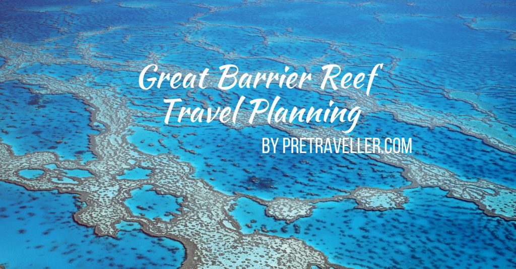
The coastal drive between Brisbane and Cairns is one of the most popular in Australia. The combination of lovely beaches, beautiful islands, national parks, Australian history, Australian wildlife, the Great Barrier Reef and gourmet food experiences make the drive an attractive option for many visitors.
Interestingly most of the best places to visit are within a short distance of the main route so to make the most of the trip you need to be prepared to go on regular side trips. All options described in this article are accessible by 2WD vehicles such as cars and vans.
This article provides a detailed overview of the main Bruce Highway route and side trip options between Gympie and Rockhampton.
Join the Great Barrier Reef Travel Planning Facebook Group
Check out our Great Barrier Reef Travel Planning Facebook Group – you are welcome to join and it is a great resource to enable you to ask questions about your Great Barrier Reef trip, including gateway towns and what to do on land!
Bruce Highway Route Overview
The major route between Gympie and Rockhampton is the Bruce Highway which can be travelled in as little as 5:12 hrs over the 467 km, 290 mi distance.
The Bruce Highway consists of mostly single carriageway roads with regular overtaking lanes and where you have to slow down to travel through towns.
The Bruce Highway is well serviced by government funded roadside stops which contain toilet facilities, picnic tables and some also have fenced playgrounds for young children. The stops are well signposted so you can plan your drive.
During peak times (school holidays and major public holidays) the Driver Reviver program also operates, which encourages drivers to take regular rest stops as they drive long distance. The Driver Reviver program offers a free cup or tea or coffee for a small donation.
There are always sections of roadworks occurring somewhere along the Bruce Highway so be prepared for periodic delays.
Bruce Highway – Gympie to Gladstone
The main route using the Bruce Highway is the direct drive from Gympie to Gladstone (364km, 226 mi, 4:10 hrs). This section of the road is more sparse than the Sunshine Coast region, but also gives you a better idea of the typical central Queensland lifestyle.
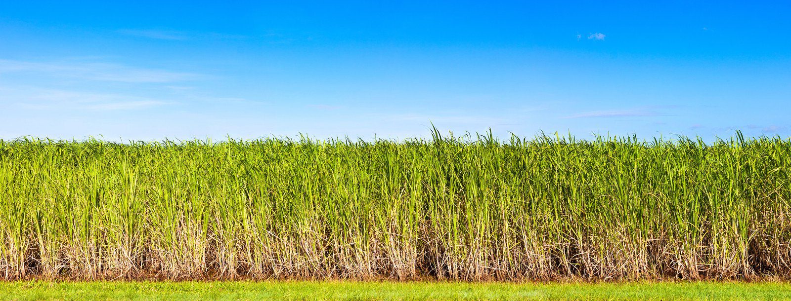
Along the way there are small towns every 50 – 100km (35 – 65 mi). You can easily stop into the historic town of Maryborough or the sugar cane towns of Childers and Gin Gin. North of Gin Gin you skirt the western edge of Lake Monduran. As you head north you can see the local peak of Mount Colosseum on the horizon, just south of the township of Miriam Vale.
The final 67km drive sees you arriving in the industrial and port city of Gladstone. From Gladstone you can also access the beautiful Heron Island, which is accessible by daily boat transfer.
Side Trip Option – Rainbow Beach, Fraser Island and Tin Can Bay
From Gympie a worthwhile side trip is a visit to Rainbow Beach, Tin Can Bay and Fraser Island (174 – 192km, 108 – 119 mi, 2:29 – 2:46 hrs).
Rainbow Beach
Rainbow Beach is a 2WD accessible patrolled surf beach which is renowned for its rainbow coloured sandy cliffs. Rainbow Beach sits within the Great Sandy National Park and has many options available for visitors.

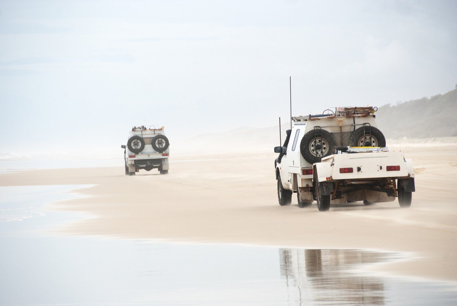
Fraser Island
Rainbow Beach is one of the gateway locations to catch a vehicle and passenger barge to the magnificent sandy World Heritage Listed Fraser Island which only takes 15 minutes each way. Fraser Island is renowned for its spectacular beaches, sand dunes, inland lakes and towering trees.
Note that Fraser Island is only accessible by high clearance 4WD vehicles, however many tour operators also provide services from Rainbow Beach for single and multi-day tours.
Another option to experience Fraser Island is to hire a 4WD vehicle for use off road or join in to a 4WD tagalong tour. Ensure you carefully read and understand 4WD hire terms and conditions otherwise you could incur significant extra expenses.
Tin Can Bay
Tin Can Bay is a sheltered watercourse which is famous for boating and fishing. Local wild dolphins visit the Norman Point boat ramp most days between 7.30 – 10.00am and may also visit at other times as they desire.
Side Trip Option – Hervey Bay, Fraser Island and Lady Elliott Island
From Maryborough a worthwhile side trip is a visit to Hervey Bay (73km, 45 mi, 1:06 hrs). Hervey Bay, while being a worthwhile destination in its own right is also the gateway to both World Heritage Listed Fraser Island and Lady Elliott Island, the southernmost tourist accessible coral cay on the over 2000km (1200 mi) long Great Barrier Reef.
Hervey Bay
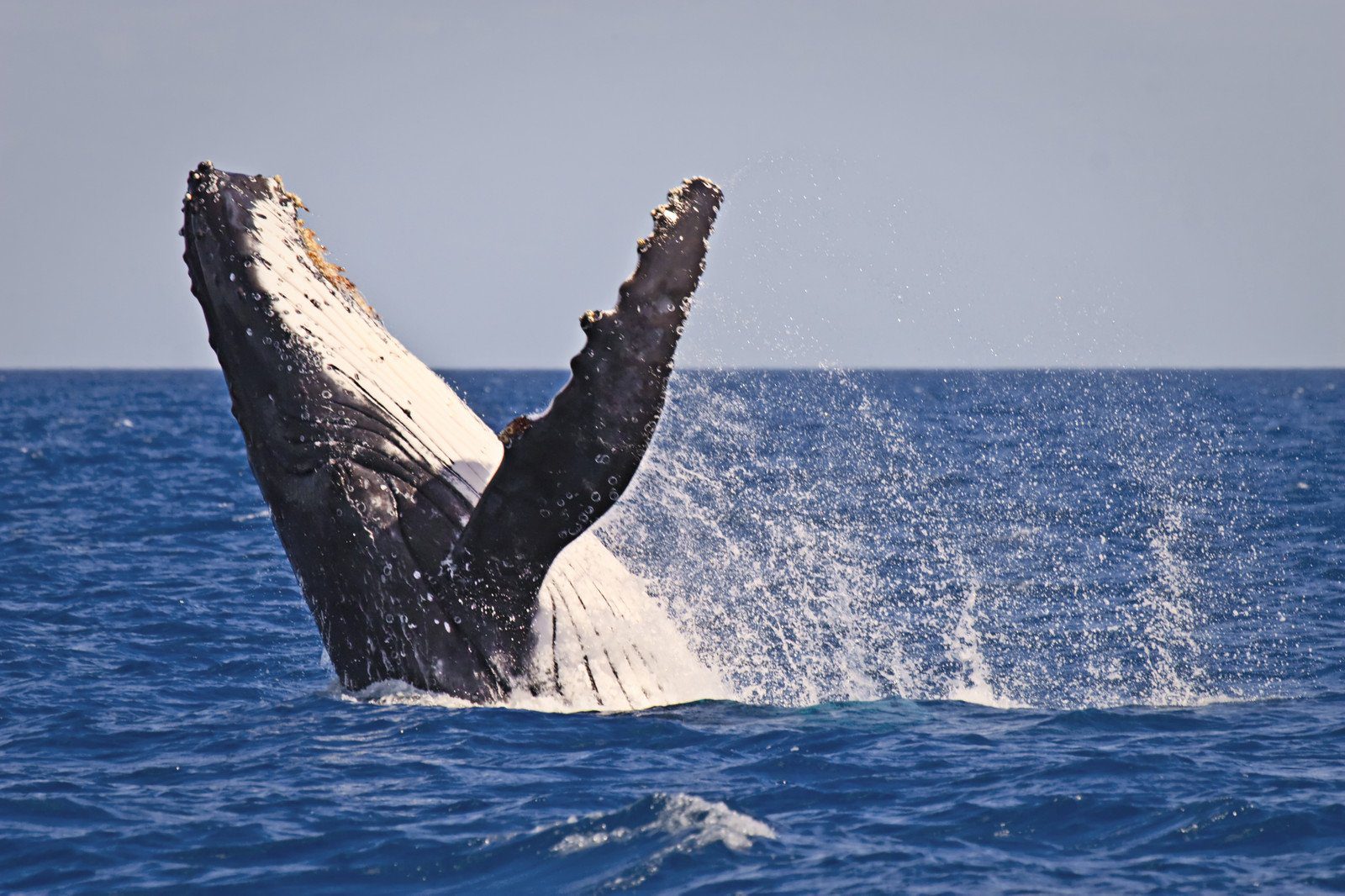
Hervey Bay is the second largest town in the region and is renowned for whale watching and water sports. The whale watching season runs from late July to November.
Fraser Island
Several vehicle and passengers barges provide transportation to Fraser Island. From the Harvey Bay region the transport time is 30-60 minutes each way.
Note that Fraser Island is only accessible by high clearance 4WD vehicles. Many tour operators also provide services from Hervey Bay for day and multi-day tours.
Another option to experience Fraser Island is to hire a 4WD vehicle for use off road or join in to a 4WD tagalong tour. Ensure you carefully read and understand 4WD hire terms and conditions otherwise you could incur significant extra expenses.
Lady Elliott Island
Lady Elliott Island is accessible by a 40 minute each way flight from both Hervey Bay and Bundaberg which depart three times daily. Lady Elliott Island is a true coral cay, with coral reef, marine life and activities such as snorkelling and scuba diving.
Side Trip Option – Bundaberg, Lady Elliott Island, Agnes Water, 1770 and Lady Musgrave Island
From Childers a worthwhile side trip is to visit Bundaberg, Agnes Water and 1770 before returning to the Bruce Highway at Miriam Vale (243km, 151 mi, 3;12 hrs). Bundaberg is an airlink gateway to Lady Elliott Island and 1770 is the only marine gateway to Lady Musgrave Island.
Bundaberg and Lady Elliott Island
Bundaberg is the largest city of the region with a population of 112,000 people. A key attraction is the factory tour of the Bundaberg Rum Factory. The Bundaberg region is a large sugar growing area and a by-product of the sugar making process is molasses which is used to make the world famous rum.
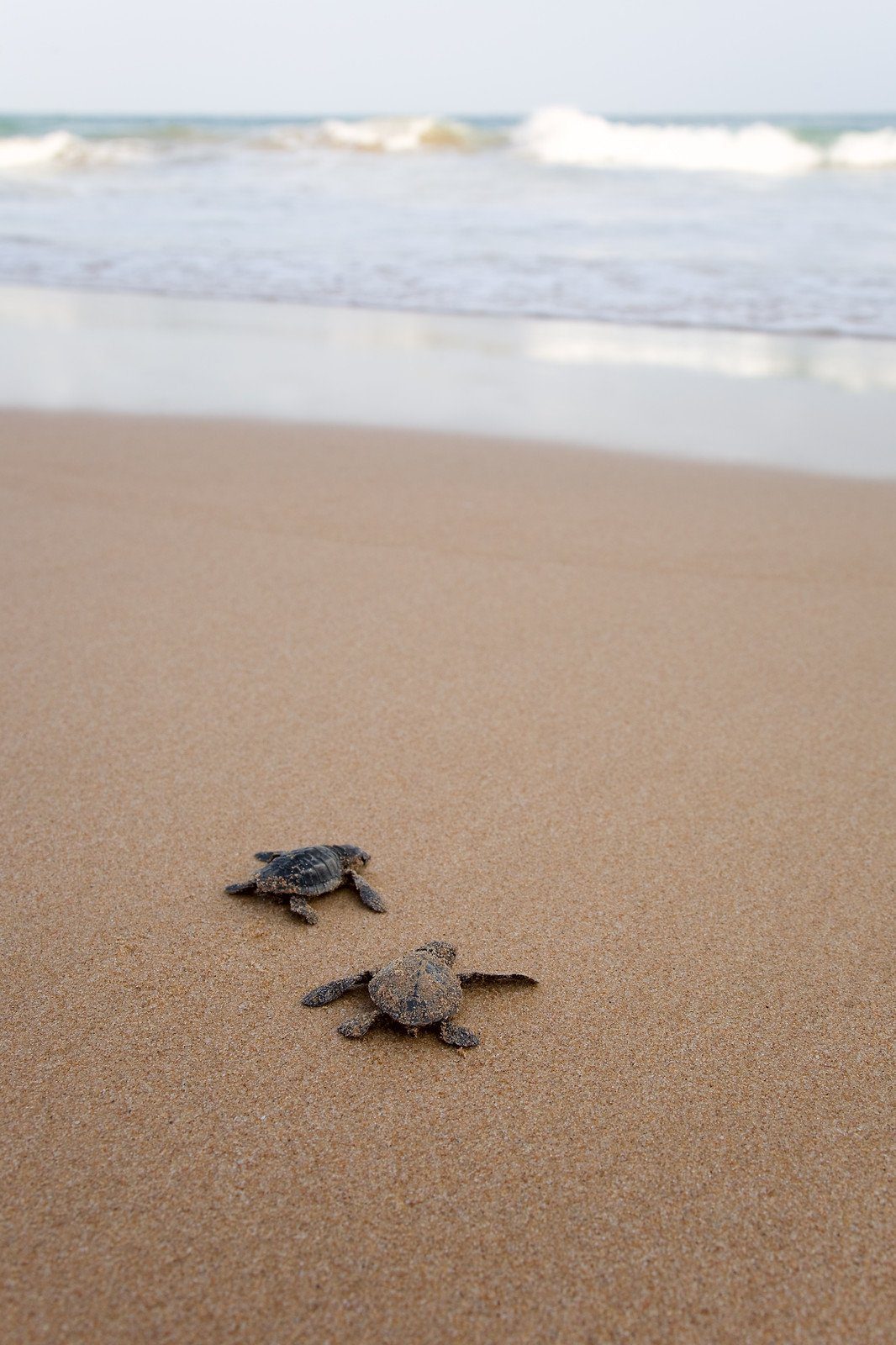
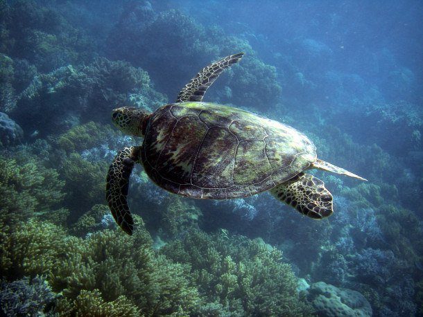
A wide range of activities are available, including easy access to Australia’s largest mainland turtle rookery at Mon Repos Beach. The turtle viewing season runs from November to February when female turtles come ashore to dig nests and lay their eggs in the sand. 6-8 weeks later the baby turtles hatch and make their hazardous way into the ocean.
Lady Elliott Island is accessible by a 40 minute each way flight from both Hervey Bay and Bundaberg which depart three times daily. Lady Elliott Island is a true coral cay, with coral reef and wildlife and activities such as snorkelling and scuba diving.
Agnes Water and 1770
The small townships of Agnes Water and 1770 are located 122km, 76 mi 1:41 hrs north of Bundaberg.
Agnes Water has Queenland’s most northerly surf beach. The Great Barrier Reef disrupts the ocean swells which means there are no surf beaches north of Agnes Waters. Agnes Water is also the access point for boat tours visiting Fitzroy Reef.
1770 (pronounced seventeen-seventy) is the location where Captain Cook made his first landing in the year 1770 in what is now Queensland.
Lady Musgrave Island
1770 is the gateway for boat trips to visit the coral cay of Lady Musgrave Island. Day trips and transfers for overnight camping options are both available.
Side Trip Option – The Burnett Highway
From Childers a worthwhile alternative driving route to Rockhampton is the Burnett Highway (sealed road) which traverses to the west of the Bruce Highway into true country Australia (500km, 311 mi, 5:52 hrs). You can also access the Burnett Highway from Maleny or Gympie if you wish to avoid the coastal route.
Along the way through the North Burnett region you can visit Gayndah which was settled in 1849 which is a citrus growing region. In Eidsvold you can visit the Eidsvold Historical Complex and the RM Williams Bush Learning Centre. Between Gayndah and Munduberra a worthwhile stop is the Gleneden Bullock Team, which puts on regular displays, check their website for details. You can also visit as part of a local tour booking. Biloela is also an interesting stop to visit The Silo which provides an overview of primary production across a range of different industries.
Cania Gorge National Park is a short distance on accessible roads from the Burnett Highway at Monto, and has a diverse range of landscapes and wildlife to see.
The Burnett Highway area is also a great place to arrange a farm stay at a working station. Farmstay options along the Burnett Highway include Myella Farmstay and Langmorn Station.
Bruce Highway – Gladstone to Rockhampton
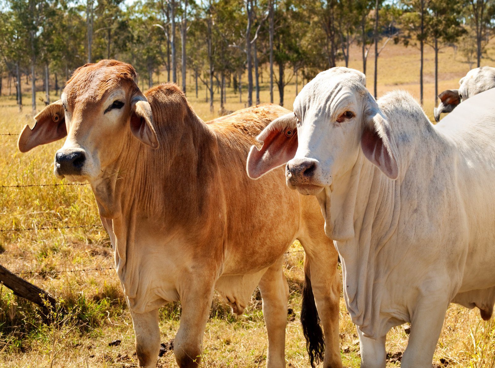
The main route using the Bruce Highway is the direct drive from Gladstone to Rockhampton (110km, 68 mi, 1:21 hrs). Rockhampton is the beef capital of Australia with many cattle stations in the local area. Mt Archer provides a spectacular backdrop to the Rockhampton township, and the Mount Archer National Park is easily accessible to observe the expansive view.
Local attractions include the Koorana Saltwater Crocodile Farm and the Aboriginal Dreamtime Cultural Centre.
When to Visit & Dangers
Weather
The Bruce Highway is accessible all year round. Spring, Summer and Autumn are the best time of year to swim at the beaches from a water temperature perspective. In Summer (December to February) temperatures are regularly in the 30 – 40 degrees C (86 – 104 degrees F) range, so ensure you carry extra water and food in your car in the event of any traffic delays. A traffic delay can sometimes cause you to wait for hours, particularly during school holiday periods. Where possible avoid travelling on the Bruce Highway at the beginning and the end of the Queensland school holidays and long weekends.
Cyclones or Hurricanes
The entire Queensland coastline can be affected by cyclones (or hurricanes) between November and April.
Humpback Whale Watching
Every year humpback whales migrate from June to August up the east coast of Australia from Antarctica to their sub-tropical breeding grounds. The humpback whales return south to the Southern Ocean from September to November. In many places along the route between Brisbane and Harvey Bay whale watching cruises are offered, and in some places you may sometimes be able to see them from shore.
Stingers (Jellyfish)
From November to June is the lethal stinger season in North Queensland when both box jellyfish (very large) and Irukandji jellyfish (very tiny) can be found along beaches, in river inlets and offshore. During November to June you should not swim in unprotected or unpatrolled beaches or river mouths. Recently (Jan 2013) two people were stung by irukandji jellyfish in two separate incidents near Fraser Island, well south of the usual known danger areas.
People are recommended to only swim at patrolled beaches inside a stinger net (note that irukandji jellyfish can get through a stinger net, so ensure that area has been cleared for use prior to swimming). More information is available from the Queensland Government Fact Sheet.
Crocodiles
North Queensland is the home for both freshwater and saltwater crocodiles which can attack and kill humans and animals. From the Gladstone region through to Cairns you should not swim in rivers, swamps or lakes unless you have been advised by a reputable source that the water is crocodile free (just because you cannot see them does not mean they are not there). Sometimes crocodiles can also be found on beaches and around offshore islands.
Do not assume that there will be signs warning of danger. Both types of crocodile can live hundreds of kilometres inland from the coast. The Department of Environment and Heritage Protection – Be Crocwise website has more information to help you to stay safe. I have also found an article which aggregates the information about both non-fatal and fatal crocodile attacks in Australia since 2002. Don’t let it be you…
Join the Great Barrier Reef Travel Planning Facebook Group
Check out our Great Barrier Reef Travel Planning Facebook Group – you are welcome to join and it is a great resource to enable you to ask questions about your Great Barrier Reef trip, including gateway towns and what to do on land!

Anne Sutherland-Smith is the creative force behind Pretraveller.com, a travel blog that specializes in offering insightful guidance for exploring Japan, South Korea, Australia, Hong Kong, and Singapore. Her passion for these diverse and dynamic regions shines through in her expert advice, particularly in helping travellers stay connected with the latest in SIM cards, pocket WiFi, and eSIMs.
With an unquenchable thirst for Asian and Oceanian cultures, Anne has carved out a niche as a knowledgeable guide for those venturing into the bustling streets of Tokyo, the historical alleys of Kyoto, the vibrant scenes of Seoul, the scenic landscapes of Australia, the vibrant markets of Hong Kong, or the futuristic cityscape of Singapore. Her articles are full of practical tips and detailed information, ensuring travellers are well-equipped for their journeys.
Anne’s approach is grounded in providing reliable, authoritative travel content that enhances the travel experience. From navigating the complexities of digital connectivity on the go to immersing in the local culture, her advice is designed to make travel both enjoyable and seamless.
WoW stunning photos and that photo from the turtle is just incredible. Looks like an amazing road trip, I really hope to be able to get there one day.
The road trip from Brisbane to Cairns has so many fantastic experiences along the way. I am currently wrestling with the next article about the section from Rockhampton to Bowen and there are so many amazing places to visit along the way!!
This is an awesome post. Very informative and well detailed post. I find it really interesting and helpful. Thank you for sharing this!